On a chilly spring morning in Brest, the sea looks like hammered pewter: dimpled, restless, quietly powerful. A low fog hangs over the harbor, softening the edges of cranes, lighthouses, and ships into ghostly silhouettes. From the quay, you can hear the slap of water against hulls and the distant clatter of rigging. Seagulls circle, loud and impatient, while the tide creeps in with the patience of centuries. Somewhere beneath this gray surface, invisible but meticulously measured, are the depths, sandbanks, channels, and underwater ridges that sailors have depended on for generations. And in a nondescript office not far from this scene, a handful of archivists and hydrographers are guarding a secret that feels almost impossible in a world obsessed with rankings and records: for more than three centuries, France has quietly held the world record for the oldest continuously operating hydrographic service on Earth — older than that of the United Kingdom, older than any other.
The Quiet French Record That Nobody Talks About
If you ask most people which country led the world in maritime charts and ocean mapping, many will confidently answer: “The British, of course.” After all, maritime lore has no shortage of stories about the Royal Navy, about Admiralty charts stacked in ship bridges, about British explorer-captains threading their way through uncharted waters with nothing but courage and ink on paper.
But the timeline tells another story — one that begins not in London, but in Paris and Brest, under the watchful eye of a king who loved order and power projected through the sea. The French Hydrographic Service, today known as the Service hydrographique et océanographique de la marine (SHOM), traces its origin back to 1720. That’s when Louis XV, then a ten-year-old king whose kingdom was effectively ruled by regents and ministers, officially created a royal service dedicated to producing nautical charts for the French Navy.
Three hundred and five years later, that same institution — modernized, renamed, digitalized, with satellites and autonomous buoys replacing some of the hand-drawn surveys of old — is still quietly at work. When you compare start dates, the numbers tilt unmistakably in France’s favor. The British Admiralty Hydrographic Office, now the United Kingdom Hydrographic Office (UKHO), dates to 1795. The French beat them by 75 years. France didn’t just get there first; it stayed, continuously, refining and updating the art of knowing what lies beneath the waves.
Yet this record sits in the shadows, largely unknown outside professional mariners, oceanographers, and a handful of historically minded sailors. In an age where every national achievement seems to be a hashtag or a competition, France’s hydrographic primacy remains almost shy — like a lighthouse that never boasts about the ships it has quietly saved.
The Age Of Wooden Ships And Paper Oceans
Imagine the year 1720. The seas are full of wooden hulls, canvas sails, and navigators with sunburned faces and ink-stained fingers. The world’s oceans, as far as European navies are concerned, are still riddled with blanks and guesses. Maps are more invitation than certainty, more aspiration than science. Coastlines might be roughly drawn; the depths of harbors are scrawled with numbers based on a handful of lead-line soundings. Sandbanks shift secretly. Reefs wait, silent and indifferent, for the next ship to misjudge a turn.
France, under Louis XV’s predecessors, had already begun to see the ocean as a strategic chessboard. Colbert, the minister under Louis XIV, had pushed for a powerful navy, and the need for accurate charts had become glaring. A single lost warship could cost more than the budget of a small town. A merchant convoy wrecked on poorly charted shoals meant not just tragedy, but economic catastrophe.
So when France formalized its Hydrographic Service in 1720, it wasn’t for romance or curiosity. It was for power, survival, and trade. Surveyors were sent to sound harbors, coasts, and approaches. They pushed lead lines over the side of yawing boats, reading off depths in fathoms or meters, and scratched notes in weather-beaten logbooks. Their work was then turned into engraved copper plates, from which charts could be printed and distributed to naval captains and merchants.
In those days, a hydrographic office was something like a cross between a war room and a scientific laboratory. Walls were covered with evolving charts; tables stacked with logs and observations; the air hazy with pipe smoke and the murmur of debates about shoals, tides, and erratic currents. The French were not alone in trying to impose order on the sea, but they were the first to maintain a dedicated, organized, state-backed institution for hydrography over centuries.
France Versus Britain: A Tale The Timeline Tells
The twist in the story, of course, is Britain. By the late 18th and 19th centuries, British sea power dominated the world. It’s the British flag we tend to picture flapping at the stern of exploratory ships in the Pacific, or naval vessels blockading Europe. The UK’s Admiralty charts became so widely trusted that, well into the 20th century, they were the default choice for mariners worldwide.
But while Britain may have won the visibility game, France had quietly played the long one. The French Hydrographic Service had already been running for decades when the British Admiralty’s Hydrographic Office was founded in 1795. By then, the French had already developed the habit — and the infrastructure — of systematically surveying, compiling, and publishing nautical charts through a centralized institution.
The irony is delicious: the country we often credit with “owning” the sea came late to the business of officially mapping it. France’s earlier start doesn’t make British hydrography less impressive, but it does shift the narrative. It reminds us that power on the water doesn’t always move in straight lines; it loops, overlaps, and sometimes hides in overlooked details. Like a reef that doesn’t show until the tide drops, the fact of France’s 305-year hydrographic record now stands clear when we look closely at the dates.
| Country | Hydrographic Service | Official Founding Year | Approximate Age (2025) |
|---|---|---|---|
| France | SHOM (Service hydrographique et océanographique de la marine) | 1720 | ≈305 years |
| United Kingdom | UKHO (United Kingdom Hydrographic Office) | 1795 | ≈230 years |
| Other nations | Various hydrographic offices | Mostly 19th century or later | Younger |
Paper Charts, Salt-Stained Fingers, And The Smell Of Ink
Walk into a historical chart room, and the first thing that hits you is the smell: a dry, slightly sweet mix of old paper, cotton gloves, and the faint ghost of ink and varnish. Pull open a flat wooden drawer and you’ll find yourself staring at the past — lines of coast traced with the care of a watchmaker, delicate hachures marking cliffs, soundings scattered like constellations of numbers across the white of the sea.
This is where France’s 305-year story becomes tactile. Early French charts were works of intense craftsmanship. Before satellites and echo sounders, surveyors used the simplest of tools: lead lines, sextants, compasses, and the patience to repeat measurements until a pattern emerged from the noise of waves and weather. The lead line — a weighted rope lowered until the weight hit the seabed — was more than a depth gauge. Sometimes the weight was hollowed and packed with tallow, a kind of sticky fat that would bring up a tiny sample of the seabed: sand, shell, mud. The texture, caught in the tallow’s greasy grip, told the surveyor if the bottom would be good holding ground for anchors or treacherously loose.
French hydrographers turned this raw data into printed charts that carried the confidence of the crown. These charts didn’t just show depths; they guided entire campaigns. They helped warships slip into or out of harbors under cover of darkness. They allowed merchant vessels to risk shorter, more profitable routes instead of sailing wide around poorly known shallows. Every neat little number and contour line was a quiet promise: trust this, and you are less likely to die here.
By the time British hydrography surged forward in the 19th century, France had already decades of this habit of measurement baked into its naval culture. The two nations, rivals on so many fronts, became unlikely partners in a shared, unspoken mission: make the sea less uncertain, one depth sounding at a time.
From Copper Plates To Digital Oceans
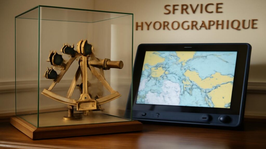
Fast-forward to today, and the scene has changed almost beyond recognition. The salty surveyors with lead lines have given way to crews operating multi-beam echo sounders that sweep the seabed with fans of sound, painting high-resolution 3D images of underwater valleys, peaks, and plains. Satellites, tide gauges, and drifting buoys whisper their data to servers in near real-time. Mariners tap glass screens instead of unfolding stiff paper charts on a chart table.
Yet, if you step into SHOM’s modern offices, you can still trace the line back to 1720. The tools are different; the impulse is the same. France’s hydrographic service still exists to answer a deceptively simple set of questions: How deep is it? What lies beneath? How does the sea behave — in calm, in storm, under moon and wind and pressure?
There is something profoundly human in this continuity. Technologies come and go, but the need to know where we are, and what waits unseen, doesn’t. You can picture a hydrographer in 1770 and one in 2025 sitting together across centuries, swapping stories: one about losing a lead line in a sudden squall, the other about a corrupted data file after a satellite glitch. Different tools; same frustration, same mission.
And the record remains: while the British UKHO has done extraordinary work and built a globally recognized brand, it still arrived more than seventy years after France’s royal hydrographers had begun the long, careful work of converting watery uncertainties into lines of ink.
Why This Record Matters In A World Of GPS And Apps
At first glance, a 305-year hydrographic record might sound like an elegant curiosity fit for a maritime museum label. In a world of GPS, satellite imagery, and navigation apps, who cares who was first to formalize a hydrographic office? But look a little closer, and the story deepens.
Hydrographic services are the quiet infrastructure of global trade. Every container ship threading its way through the English Channel, the Strait of Singapore, or past the coral-strewn Pacific islands is relying on charts that owe their existence to institutions like SHOM and UKHO. Ninety percent of world trade by volume rides the sea; without reliable charts, many of those ships would be gambling with their hulls, their cargo, and their crews.
France’s exceptionally long hydrographic history means that it has been building, testing, and refining its understanding of coasts and depths for generations. That continuity matters, especially now. Climate change is reshaping shorelines; storm surges reach farther inland; sedimentation and erosion alter channels and approaches. Old assumptions about water levels and safe passages are being challenged by a warming world. Hydrographic offices are on the front line of documenting — and adapting to — these changes.
There’s also a quieter cultural impact. Long-lived institutions shape the way a country thinks about the sea. In France, hydrography has fed not just naval strategy, but scientific oceanography, coastal engineering, environmental protection, and even the poetic imagination of writers who stand on Atlantic cliffs and know, more or less, what lies below the waves they describe. A 305-year record isn’t just about who started first. It’s about holding a conversation with the sea for three centuries without stopping.
The Humble Heroism Of Knowing Where Not To Go
We tend to celebrate explorers for the lands they “discovered,” the peaks they climbed, the routes they opened. Hydrographers, on the other hand, specialize in discovering where not to go. Their victories are measured in absences: ships that did not run aground, tankers that did not spill oil on fragile coasts, ferries that did not vanish in storms because their captains knew exactly how much water lay under the keel.
In that sense, France’s long hydrographic record is a chronicle of avoided disasters. Each new edition of a chart, each corrected depth, each updated tidal stream replaced doubt with knowledge. Over 305 years, that slow, quiet accumulation of detail has likely spared countless hulls from splintering on unseen rock. Yet no monument commemorates the rock you never hit.
This is perhaps why so few people know about France’s record. It is a story of precision rather than panache, of incremental safety rather than dramatic conquest. But in a world that increasingly recognizes the value of resilience, foresight, and careful stewardship, perhaps it’s time we gave such records the attention they deserve.
A Record Written In Water, Remembered In Ink
Back on the quay in Brest, the tide has risen. The fog shifts, revealing the jagged outline of a distant breakwater. A pilot boat noses out from the harbor, low and purposeful. On its bridge, an electronic chart glows softly, showing depths, contours, and buoys in sharp detail. Somewhere in that digital mosaic are traces of surveys done centuries apart: a sounding first taken with a lead line in the age of sail, later refined with echo sounders, now embedded in a constantly updated global database.
France’s 305-year hydrographic record doesn’t exist in a glass case. It exists out here, under the hulls of working ships, in the confidence of captains steering through narrow channels on stormy nights, in the quiet assurance that someone, long before, has taken the time to ask the sea difficult questions and write down its reluctant answers.
The United Kingdom’s hydrographic achievements remain immense, and its charts are rightly trusted around the world. But alongside that story sits France’s less trumpeted claim: the oldest continuously operating hydrographic service in the world, born in 1720 and still patiently listening to waves, currents, and tides three centuries later.
In the end, this is not a record of national bragging rights so much as a reminder of something deeper. Long before we had satellites and smartphones, nations invested in the slow, meticulous work of making the oceans legible. They did it with rope and lead, with paper and ink, with small boats in big swells. They did it because the sea, for all its beauty, is not forgiving of ignorance.
So the next time you stand on a ferry’s deck, watching the coastline recede, or see a container ship sliding almost silently along the horizon, remember this: beneath every smooth passage are centuries of unseen labor. And somewhere in the great ledger of maritime history, written not in headlines but in thousands of meticulously updated charts, is a quiet line that reads: France has been at this longer than anyone — 305 unbroken years of asking, measuring, and mapping the shifting blue world we depend on.
FAQ
What exactly is a hydrographic service?
A hydrographic service is a national or official organization responsible for measuring and describing the physical features of oceans, seas, coastal areas, lakes, and rivers. Its main product is nautical charts and related data that support safe navigation, maritime trade, naval operations, and coastal management.
When was France’s hydrographic service founded?
France’s hydrographic service was officially founded in 1720 under the authority of the French crown. Over time it evolved into today’s SHOM (Service hydrographique et océanographique de la marine), but it has maintained an unbroken institutional lineage for more than 305 years.
How does this compare to the UK’s hydrographic office?
The United Kingdom Hydrographic Office (UKHO) traces its formal origin to 1795. That means France established its official hydrographic service about 75 years earlier, giving it the distinction of being the world’s oldest continuously operating hydrographic office.
Why does hydrography still matter in the age of GPS?
GPS tells you where you are on the Earth’s surface, but not what lies beneath the water. Hydrography provides the depth data, seabed characteristics, coastlines, and tidal information that make navigation safe. Modern navigation systems, electronic charts, and maritime apps all rely on hydrographic data as their foundation.
Is hydrographic work only about making maps?
No. While nautical charting is central, hydrographic services also support environmental monitoring, coastal engineering, marine renewable energy projects, naval planning, search and rescue operations, and scientific oceanography. Their data are crucial for understanding and managing the changing coastal and marine environment.
How did early hydrographers measure depths without modern technology?
Early hydrographers used simple tools like lead lines — ropes with a weight attached, sometimes coated with tallow to bring up seabed samples. They combined these depth soundings with angle measurements from sextants and careful observations of tides and landmarks to create charts. It was slow, physically demanding, and often dangerous work.
Will paper nautical charts disappear completely?
Electronic charts are increasingly dominant, especially for commercial shipping, but paper charts still have a role as backups and for training. Many mariners value the big-picture overview that a large paper chart provides. Over time, some paper coverage may shrink, but the underlying hydrographic data — the true heart of the work — will remain essential, whatever form it takes on board.


